New York, NY – A pair of powerful storm systems is forecast to sweep across the United States beginning late this week, bringing widespread rain, accumulating snow in higher elevations, and a growing risk of severe thunderstorms for millions of people. Forecasters say the back-to-back storms could impact more than 30 states, with conditions worsening from Thursday into the weekend.
Meteorologists note that forecast confidence has increased after computer models shifted from predicting a single system to now showing two distinct storms moving eastward from the southern Rockies in quick succession.
The developing weather pattern involves two areas of low pressure expected to emerge from the southern Rockies starting Thursday, each capable of producing heavy rain, severe thunderstorms, and winter weather. The first storm will move quickly across the country, while the second is expected to reinforce rainfall totals and extend hazardous conditions into the weekend.
Millions across the Southern Plains, Midwest, Deep South, Northeast, and Upper Midwest are likely to experience disruptive weather ranging from flash flooding to snow and strong winds. Here is a brief timeline of events –
Thursday: First Storm Begins Cross-Country Sprint
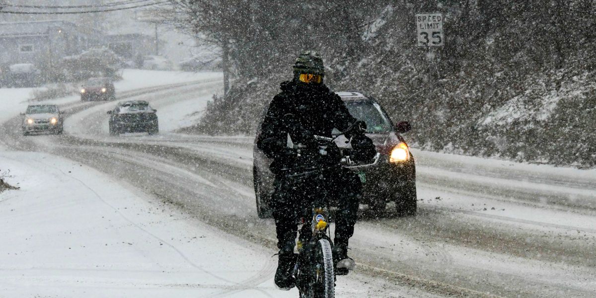
The first storm system is expected to race out of the Southwest on Thursday, spreading rain across much of the Southern Plains, including Oklahoma and North Texas. A low-level severe thunderstorm threat is forecast from Wednesday night into Thursday, stretching into Arkansas and southern Missouri.
Snow showers are also possible in higher elevations across parts of New Mexico, Colorado, Utah, and Arizona, particularly in mountainous terrain where colder air will be in place.
As the system accelerates eastward, a broad swath of rain is forecast to overspread the Midwest, Mississippi Valley, and Tennessee Valley by Thursday afternoon. A low-end flash flood threat has been identified for Chicagoland, parts of Illinois, Wisconsin, and Indiana.
Friday: Severe Weather Threat Grows in the Deep South

By Friday, the cold front associated with the first storm will push into the Deep South, setting the stage for potentially more dangerous weather.
The NOAA Storm Prediction Center has issued a Level 2 out of 5 risk of severe thunderstorms for portions of the Lower Mississippi and Tennessee valleys, including parts of Missouri, west Tennessee, Arkansas, Mississippi, Alabama, and Louisiana. Cities within the risk zone include Memphis, Tennessee, Jackson, Mississippi, and Alexandria, Louisiana.
“These storms could be capable of generating damaging wind gusts, hail and possibly tornadoes,” forecasters warned.
At the same time, the second storm system is expected to take shape in the Four Corners region and move out of the southern Rockies, delivering another round of rain to many of the same areas affected by the first storm.
According to the NOAA Weather Prediction Center, a Level 2 out of 4 flash flood threat has been issued for Middle Tennessee and northwestern Alabama, placing the Nashville and Huntsville metro areas at elevated risk. More details on the severe weather outlook can be found through the NOAA Storm Prediction Center.
Rain from the first storm is expected to reach the Northeast and New England, including Washington, D.C., Philadelphia, New York City, and Boston, by Friday morning.
Weekend: Washout for the East Coast
Rain is forecast to linger across the Southeast into Saturday morning as the second storm shifts into the Great Lakes region by the afternoon. Colder air wrapping into the system may lead to gusty winds and snow across Wisconsin, Michigan, northern Illinois, and northern Indiana, as well as along the eastern shores of Lakes Erie and Ontario.
Meanwhile, showers and thunderstorms are expected to continue along much of the Northeast and New England coasts through Saturday, potentially disrupting travel plans and outdoor activities.
Weather Safety and Public Awareness
With multiple hazards possible, including flash flooding, damaging winds, and winter weather, residents are urged to monitor local forecasts closely. Motorists should avoid driving through flooded roadways, while those in severe weather risk areas should review tornado safety plans and ensure they can receive weather alerts overnight.
Conclusion
Forecasters expect conditions to gradually improve by late Sunday, with most regions drying out by Monday. However, officials stress that impacts may vary significantly by location as the two storms move across the country.
Residents in affected areas are encouraged to stay informed and prepared as this active weather pattern unfolds. Share your experiences in the comments below.