Denver, Colorado – Meteorologists are tracking a shift in Colorado’s weather pattern as strong winds and elevated fire danger give way to cooler temperatures and increasing snow chances later this week. While Denver enjoys mild and breezy conditions early in the week, a developing storm system is expected to bring rain and snow to the Front Range beginning Thursday.
Forecasters say the transition could lead to slick travel conditions, especially for the Friday morning commute, as temperatures drop sharply behind the system.
Tuesday’s weather across the Denver metro area and Colorado’s Front Range is dominated by strong winds, sunny skies, and above-average temperatures. However, this calm appearance masks critical fire weather conditions that prompted a Red Flag Warning from the National Weather Service due to warm, dry, and windy conditions.
Looking ahead, a late-week storm is expected to lower temperatures significantly and introduce the potential for snow accumulation, particularly along the Front Range and higher elevations.
Windy and High Fire Risk Conditions on Tuesday
Denver is expected to reach a high near 59 degrees on Tuesday, with breezy to windy conditions persisting throughout the day. The strongest winds are forecast across the foothills, Boulder, and Denver’s western suburbs, where gusts could be strong enough to rapidly spread any fire that ignites.
The National Weather Service issued a Red Flag Warning through 5 p.m. Tuesday, citing critical fire danger.
“Warm, dry and windy conditions are the recipe for critical fire danger,” the agency warned, urging residents to avoid outdoor burning or any activity that could create sparks.
Snow showers in Colorado’s mountains are expected to taper off by Tuesday evening, allowing for improving conditions in higher elevations before the next system arrives.
Midweek: Mild and Above Average Temperatures
Conditions are expected to remain quiet on Wednesday, with mostly sunny skies and highs reaching the upper 50s in Denver. This is well above the city’s average early January high of 44–45 degrees, providing a brief stretch of mild winter weather.
Despite the warmth, forecasters caution that breezy conditions may persist, keeping fire danger concerns elevated in dry areas.
Thursday–Friday Storm Brings Snow Potential
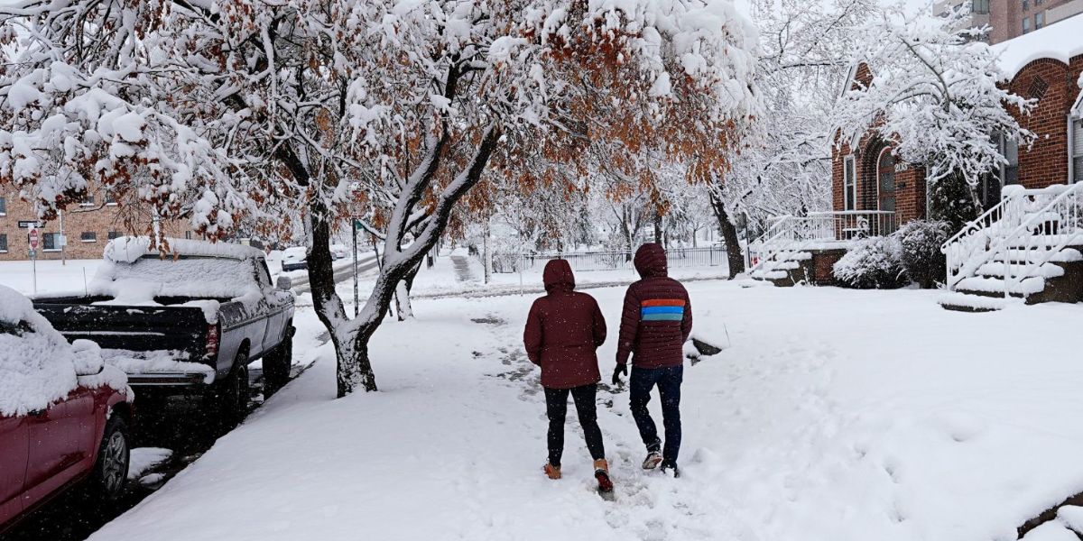
A change arrives on Thursday as the next storm system approaches Colorado from the west. Meteorologists say this system will bring cooler air and much-needed precipitation to the region.
High temperatures in the Denver area are expected to drop into the low 40s, with a chance of rain and snow showers across the metro area and Front Range. Depending on the storm’s timing and intensity, some locations along the Front Range could see snow accumulation by Thursday evening.
“Depending on the timing, the Front Range could see some snow accumulation through Thursday evening,” local forecasters noted, adding that this could result in slick roads for the Friday morning commute.
Overnight lows are forecast to fall into the low 20s, increasing the risk of icy conditions on untreated roads.
Friday and Beyond: Clearing Skies, Colder Air
Skies are expected to clear relatively quickly on Friday, but colder air will remain in place behind the storm. Daytime highs are forecast to recover slowly into the mid-30s to low 40s by Friday afternoon, with overnight lows dipping to around 19 degrees.
The weekend outlook appears more favorable, with mostly sunny skies and gradually warming temperatures. Highs are expected to reach 45 degrees Saturday and climb into the low 50s by Sunday, offering improved travel and outdoor conditions.
Key Forecast Details for Denver
- Tuesday: Mostly sunny, high 59, low 35
- Wednesday: Mostly sunny and breezy, high 56, low 32
- Thursday: Mostly cloudy and cooler, chance of flurries, high 41, low 25
- Friday: Chilly and dry, high 36, low 19
- Saturday: Mostly sunny and mild, high 45, low 27
- Sunday: Mostly sunny and cool, high 53, low 26
Weather Safety and Awareness
Residents are urged to remain cautious during Tuesday’s Red Flag Warning, avoiding outdoor activities that could spark fires. Later in the week, drivers should prepare for changing road conditions, particularly late Thursday night and early Friday when temperatures drop below freezing.
Up-to-date forecasts and safety guidance are available through the National Weather Service and local weather authorities.
Conclusion
Denver’s weather will shift rapidly from warm, windy, and fire-prone conditions to colder temperatures with the possibility of snow by the end of the week. While impacts appear manageable, timing and accumulation could affect travel, making it important to stay informed.
Share your experiences in the comments below.