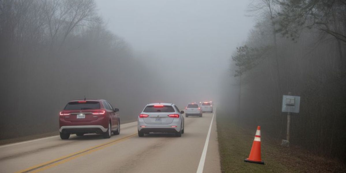
Birmingham, AL — A Dense Fog Advisory remains in effect through Thursday morning as central and north Alabama enter an unusually warm and increasingly volatile weather pattern ahead of heavy rain and potential severe storms expected Friday into Saturday.
Forecasters warn that multiple hazards — including reduced visibility, flooding rainfall, damaging winds, and a sharp temperature drop — could affect travel and daily routines over the next several days.
Dense Fog Advisory Through Thursday Morning
The Dense Fog Advisory remains active until 9 a.m. Thursday, with visibility dropping to less than 100 yards in some communities. The fog is expected to be thickest during the early morning hours, creating hazardous driving conditions, particularly on rural roads and near waterways.
The National Weather Service urges drivers to slow down, use low-beam headlights, and allow extra travel time during the morning commute.
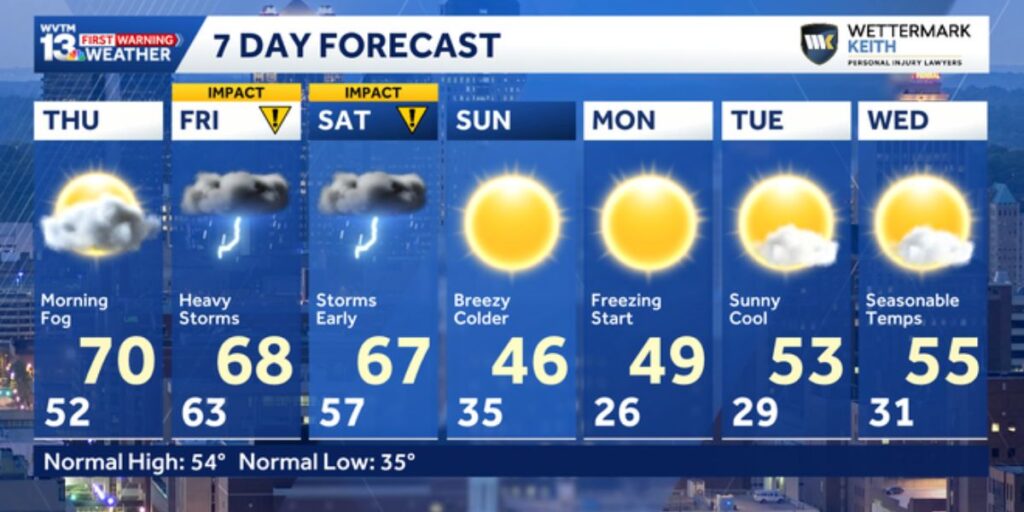
Thursday: Warm, Muggy, and Unseasonable
Thursday will feel more like early spring than mid-winter. High temperatures will climb into the upper 60s and lower 70s, well above seasonal averages. Southerly winds will increase throughout the day ahead of an approaching cold front, with gusts reaching up to 20 mph.
A few isolated showers may develop, but no widespread rainfall is expected. Humidity levels will remain elevated, adding to the muggy feel. The warm air mass puts the region within striking distance of January records — the warmest January temperature on record is 74 degrees, set in 2008.
Friday: Heavy Rain and Storms Develop
Friday marks the beginning of a First Warning Impact Day, as conditions turn increasingly unsettled. The day will be breezy, warm, and humid, with widespread rain and thunderstorms likely from morning through evening.
Forecasters expect 1 to 2 inches of rain in many areas before mid-afternoon. However, the most concerning weather is expected late Friday night into early Saturday, when stronger storms may develop.
The Storm Prediction Center has placed parts of northwest Alabama under a Level 2 of 5 (Slight Risk) for severe weather, with the remainder of the state under a Level 1 of 5 (Marginal Risk).
Severe Weather and Flooding Concerns
The primary threats include damaging wind gusts, hail, and the possibility of a brief tornado, though instability levels remain uncertain. Even if storms are less intense, heavy rainfall poses a significant flooding risk, especially along and north of Interstate 20.
Rainfall totals could exceed 3 inches in localized areas, raising concerns for flash flooding. The Weather Prediction Center highlights north and northwest Alabama under a slight risk for excessive rainfall, meaning rapid runoff could overwhelm creeks, streams, and urban drainage systems.
While rainfall is desperately needed, meteorologists caution that too much rain too quickly may cause travel disruptions and property issues.
Saturday: Storms Exit, Cooler Air Arrives
Storms will continue into Saturday morning, gradually shifting south. Rain and thunderstorms should exit by early afternoon, allowing conditions to improve later in the day.
Behind the cold front, breezy northwest winds will usher in cooler and drier air. Temperatures will fall steadily through the afternoon, signaling a dramatic shift from the warmth experienced earlier in the week.
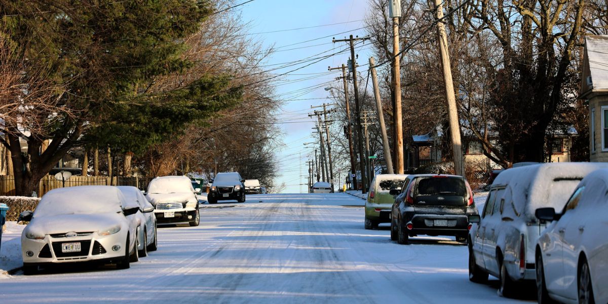
Sunday Through Tuesday: Sharp Cooldown and Freezes
Sunday will start noticeably colder, with morning lows in the 30s and afternoon highs in the upper 40s to lower 50s under sunny skies.
A widespread freeze is likely Monday morning, particularly across central and north Alabama, with lows in the upper 20s to low 30s. Another hard freeze is possible Tuesday morning, with temperatures dipping just below freezing before rebounding into the low 50s during the afternoon.
By early next week, temperatures will fall closer to seasonal averages. For reference, average January temperatures in Birmingham are 35 degrees for morning lows and 54 degrees for afternoon highs.
What to Watch Going Forward
Forecasters continue to fine-tune storm timing and intensity. Residents are encouraged to monitor updates, enable weather alerts, and prepare for changing conditions — especially late Friday into early Saturday.
Drivers should remain cautious during foggy mornings, heavy rain, and post-storm icy conditions early next week.
Share your experiences in the comments below.