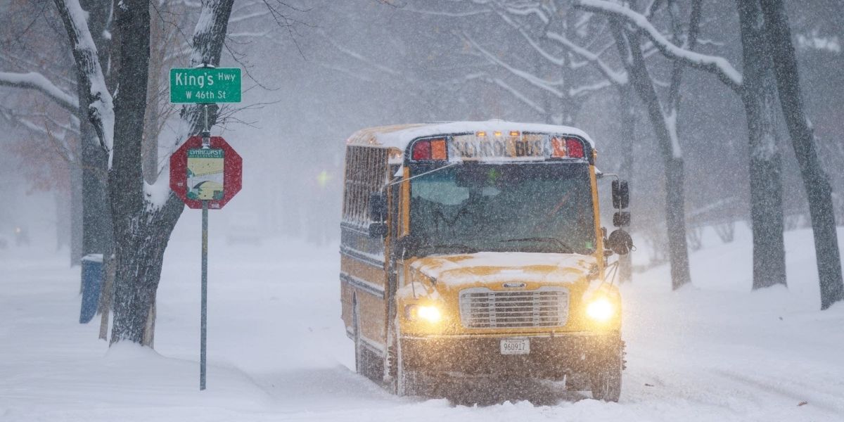
Rochester, N.Y. – A Yellow Alert has been issued for the Rochester region as forecasters warn of returning snow and a surge of bitterly cold air that could impact the Thursday morning commute, particularly in northern counties influenced by Lake Ontario. While snowfall amounts remain uncertain, officials say hazardous travel conditions and dangerously cold wind chills are increasingly likely.
Forecast Overview
Meteorologists say the developing system is complex and still evolving, even with the event just days away. Snow could begin as early as Wednesday night, with the most significant impacts expected early Thursday morning.
The Yellow Alert highlights the potential for slippery roads, reduced visibility, and rapidly changing conditions during the morning commute, especially across northern tier counties, where lake-enhanced snowfall could intensify.
Two Possible Storm Scenarios
Forecasters are closely monitoring two primary scenarios that will determine how impactful the system becomes.
In the first scenario, a stronger area of low pressure develops and tracks favorably across the region. If this occurs, Rochester and surrounding areas could see a broader area of accumulating snow, followed by lake-enhanced snowfall as colder air pours in behind the system.
The second scenario keeps the low pressure system much weaker, limiting the potential for widespread snow. Even in that case, however, lake-effect snow would still develop as cold air moves over the relatively warmer waters of Lake Ontario.
Because both scenarios remain plausible, snowfall totals and timing remain uncertain, contributing to the elevated alert level.
Timing and Commute Impacts
If area-wide snow develops, it is expected to taper off by Thursday morning, though lake-effect snow could linger into the afternoon hours. These lingering snow bands may be localized but intense at times, particularly north and northeast of Rochester.
Even brief periods of snow during peak travel hours could create slick roadways, especially as temperatures fall rapidly. Drivers are urged to allow extra travel time and remain alert for sudden changes in visibility.
Lake Ontario’s Role
Lake Ontario will play a key role in shaping snowfall distribution. Northern communities closer to the lakeshore are more likely to see heavier snow bursts, especially if winds align favorably for lake enhancement.
Lake-effect snow is notoriously difficult to predict, with conditions varying dramatically over short distances. One community may see steady snow while another just a few miles away sees minimal accumulation.
Bitter Cold Follows the Snow
Beyond the snow, the cold air accompanying this system poses a serious concern. High temperatures on Thursday are expected to fall back into the teens, with a brisk wind making it feel significantly colder.
Wind chill values are forecast to drop below zero by Thursday afternoon and evening, increasing the risk of frostbite for anyone exposed to the elements for extended periods.
Residents are urged to dress in layers, limit time outdoors, and ensure pets are brought inside during the coldest periods.
Lingering Lake-Effect Snow
As the cold air settles in, lake-effect snow may persist through Thursday afternoon, though forecasters expect it to gradually weaken later in the day. Even light lake-effect snow can create localized travel hazards due to blowing snow and icy surfaces.
Because of the uncertain storm track and temperature profiles, officials stress that forecast details may change leading up to the event.
Extended Cold Pattern Ahead
Once this blast of arctic air arrives, the region is expected to remain locked in a deep freeze for at least the next week. While there may be brief moderation periods, overall temperatures are forecast to stay well below normal.
Prolonged cold can strain heating systems, increase energy usage, and raise safety concerns related to space heaters and carbon monoxide exposure.
Public Safety Reminder
Drivers are encouraged to monitor forecasts closely, ensure vehicles are winter-ready, and keep emergency supplies on hand. Slippery roads combined with extreme cold can quickly escalate minor issues into serious situations.
Share your experiences in the comments below.