Houston, TX – Houston is preparing for the coldest temperatures of the season as a strong cold front arrives Friday and arctic air pushes in by Saturday. Forecasters warn the region could face an impactful winter weather setup this weekend, including the potential for freezing rain Saturday night into early Sunday, which could create icy roads and isolated power outages.
Incident Overview
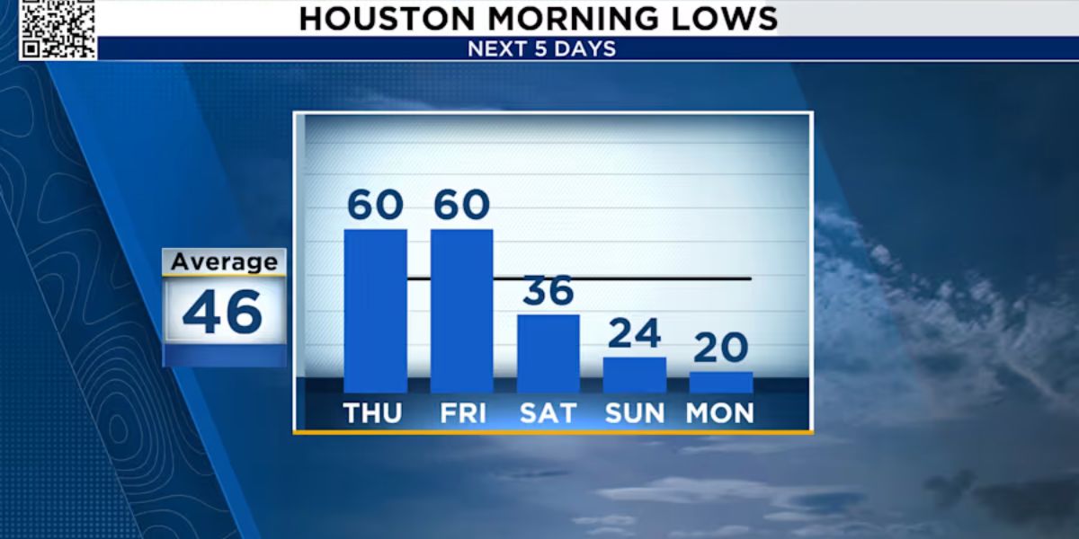
A dramatic temperature drop is expected across the Houston area, with highs falling from the 70s on Friday to the lower 40s on Saturday, and potentially the upper 30s by Sunday. Morning lows are forecast to dip into the 20s and 30s, making this the most significant cold stretch Houston has experienced so far this season.
Meteorologists are closely monitoring the possibility of freezing rain, which is considered one of the most hazardous types of winter precipitation due to its ability to quickly coat roads, bridges, and elevated surfaces with ice.
Timeline of Events
The shift begins Friday as a cold front moves through, followed by the arrival of arctic air on Saturday. While much of Saturday may feature cold rain, the most critical timing window for freezing rain appears to be Saturday night, when temperatures are expected to fall below 32 degrees while moisture remains in place.
Conditions may remain unsettled through early Sunday morning, with the risk of icy roadways increasing as temperatures stay at or below freezing. Forecasters expect most of the freezing rain and sleet threat to taper off by around noon Sunday, but temperatures may remain close to freezing through the afternoon.
What Freezing Rain Means for Houston
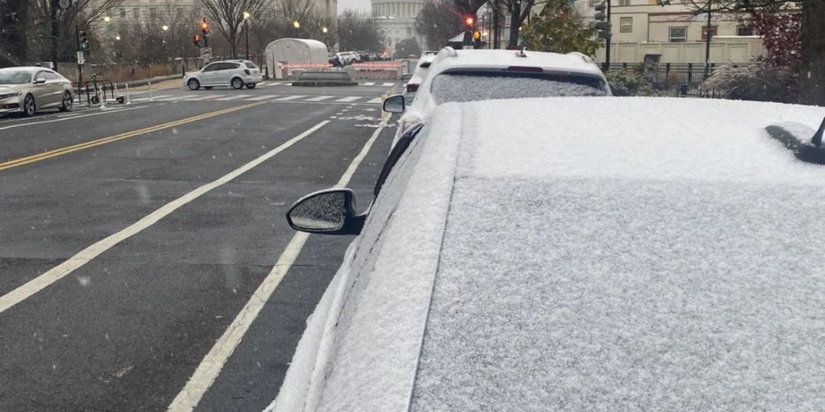
Freezing rain forms when rain falls through a warm layer of air and then freezes instantly upon contact with surfaces that are below 32 degrees. Even a thin glaze of ice — less than one-tenth of an inch — can create major problems for drivers and first responders.
This type of ice buildup can also weigh down tree limbs and power lines, increasing the risk of scattered outages, especially if ice accumulates on branches near electrical infrastructure.
Where Ice Could Develop First
As arctic air filters into Southeast Texas Saturday afternoon, areas north of Houston may begin seeing ice earlier than the metro area. For Houston proper, the changeover from cold rain to freezing rain is expected to occur overnight Saturday night, when temperatures drop below freezing and precipitation is still ongoing.
By early Sunday morning, lingering freezing rain combined with below-freezing temperatures could create slick roadways, particularly on bridges, overpasses, and less-traveled streets that cool faster than main roads.
Wind Chills and Bitter Cold Conditions
In addition to ice potential, the cold air mass will bring strong winds that could push wind chills into the teens, making it feel dangerously cold for anyone outdoors for extended periods.
Even after precipitation ends, the cold may linger long enough to limit melting. With Sunday highs expected to hover near freezing, any ice that forms could remain in place through the day, keeping travel conditions hazardous well beyond the end of the precipitation.
Safety and Awareness: How to Prepare
Houston residents are urged to prepare now, especially since freezing rain events are less common in the region and can catch drivers off guard. Safety officials generally recommend:
- Avoid driving Saturday night and early Sunday if freezing rain develops
- Be cautious on bridges and overpasses, which ice over first
- Charge phones and keep flashlights ready in case of power outages
- Protect pets, pipes, and plants as temperatures fall into the 20s and 30s
- Dress in layers and limit time outside due to dangerous wind chills
If roads do ice over, even short trips can become risky, and emergency response times may slow due to widespread hazardous driving conditions.
Conclusion
Houston is facing a sharp cold snap this weekend, with arctic air arriving Saturday and the potential for freezing rain Saturday night into Sunday morning. With temperatures near freezing and wind chills in the teens, any ice that forms could linger through Sunday, making travel conditions especially dangerous.
Share your experiences in the comments below.