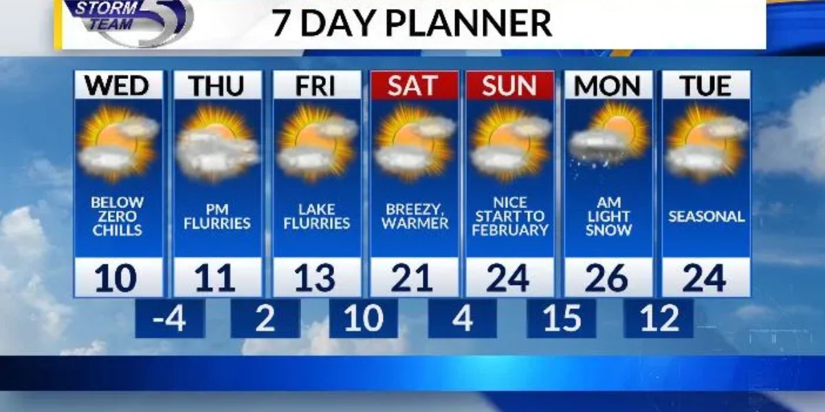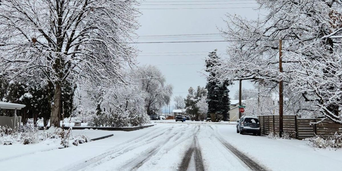
Boise, ID – A brief round of light snow is expected to move through southern Idaho early Thursday morning, potentially creating slick travel conditions during the morning commute. Forecasters say the impacts should be minor overall, but drivers across the Treasure and Magic Valleys are urged to use caution, especially before sunrise.
Snowfall is expected to be short-lived, with improving conditions by late morning as temperatures rise and accumulations melt.
Periods of light snow are forecast from approximately 1 a.m. to 6 a.m. Thursday, affecting the Treasure Valley, Magic Valley, and the heavily traveled I-84 corridor. While widespread heavy snowfall is not expected, even small accumulations could briefly stick to colder surfaces during peak commute hours.
Forecasters say a trace to 1 inch of snow is possible in many areas, with slightly higher amounts east of Boise, particularly on grassy and elevated surfaces.
Timeline of Expected Conditions
Snow is expected to develop during the early overnight hours Thursday, becoming most noticeable in the pre-dawn window. The timing aligns with school drop-offs and early work commutes, increasing the likelihood of travel slowdowns.
As daylight arrives and temperatures climb later in the morning, snowfall should taper off, allowing road conditions to improve rapidly by midday.
Areas Most Likely to See Snow
The system is expected to impact a broad portion of southern Idaho, including:
- Boise and surrounding Treasure Valley communities
- Magic Valley locations
- I-84 corridor, a key travel route for commuters and freight traffic
Snow accumulation will vary by location, with east of Boise having the best chance of seeing slightly higher totals.
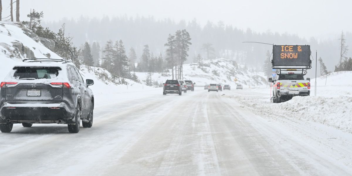
Impacts on Roads and Travel
Although snowfall amounts are expected to remain light, officials warn that snow could briefly stick to roads, especially on:
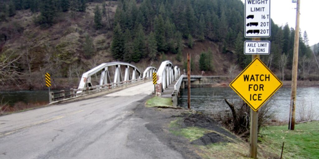
- Bridges and overpasses
- Sidewalks and untreated roads
- Shaded areas that remain colder
“Travel impacts should be minor but noticeable, particularly during school drop-off and early commutes,” forecasters noted.
Drivers may encounter slick spots before sunrise, when pavement temperatures are coldest and melting is less effective.
What to Expect as Temperatures Rise
One positive factor with this system is the warming temperatures later in the morning. As snow ends and daytime heating increases, any accumulation should melt quickly, leading to steadily improving travel conditions.
By late morning to midday, most roadways are expected to be wet rather than icy, significantly reducing hazards for afternoon travel.
Safety and Preparedness Tips
Drivers and commuters are encouraged to take simple precautions to reduce risk:
- Plan for a slower-than-normal Thursday morning commute
- Allow extra time for school drop-offs and early errands
- Use caution on bridges and overpasses, where icing develops first
- Drive defensively and increase following distance
- Watch for briefly heavier snow bands, which could reduce visibility
Pedestrians should also be mindful of slick sidewalks and parking lots during the early morning hours.
Monitoring Conditions
Because snow bands can be uneven and localized, conditions may vary significantly across short distances. Forecasters recommend checking updated weather statements and road conditions through the National Weather Service, which continues to monitor snowfall potential across southern Idaho.
Road crews are expected to monitor conditions closely, though widespread treatment may not be necessary given the limited accumulation forecast.
Conclusion
Thursday’s early-morning snow event is expected to be brief and light, but its timing could still cause minor travel disruptions across Boise and surrounding valleys. By staying cautious and allowing extra time, most commuters should be able to navigate the morning safely as conditions improve by midday.
Share your experiences in the comments below.